
Hike to Horseshoe Palms
Since the next day would be Fathers' Day, my oldest daughter decided she wanted to do something special with me. I liked the concept, so I agreed. Then she asked me what I want to do. Well, since I'm on stand-by for my work, I'm somewhat limited in how far I can go and how long I can be gone, which puts me in a quandary. My wife comes to the rescue and suggested we go on a hike, which may have been their plan all along. So far, so good. Next we have to decide on what time to hike. The weather had been mostly mild for the last several weeks, with unseasonably cool weather, for us anyway. But in the past few days the temperatures had been warming up. We decide that since it will be warm or even hot, to leave early. Now Dorothy is not normally a morning person, so I was reluctant to suggest an early hour, but she's game for the idea and 0630 is agreed on.

My hiking partner, must be having fun
Sure enough, Dorothy is up bright and early and we leave right on time. It is already in the low 80s as we head out, but doesn't seem to bad. We stop for breakfast and then it's out to the Coachella Valley Preserve. As we drive out we notice that the air quality is poor due to humidity. We park along the road a little way before the visitor center, since I decided to hike over towards Pushawalla Palms. I think the views are better and the geology is more interesting than in the area of the main oasis.

The trailhead
We started our hike at 0730 and soon were hiking up the steep section of the trail that takes one up onto Bee Rock Mesa and the fork in the trail that leads to the ridge trail that runs above the Horseshoe Palms Oasis or Bee Rock Mesa. They have done some improvements to this portion of the trail, but I notice that it still has me breathing heavy by the time I reach the top. We then head on up the ridge.

Fork in trail with ridge in background
The views were not the best, due to the poor air quality, but what the heck, I'm out with my daughter getting some good exercise, life is good. Then I hear a strange buzzing noise, it sounded like about a thousand crickets all making a racket. I'm thinking to myself that this doesn't seem quite right when Dorothy asked me, "Is that a rattlesnake?". Suddenly the light went on, I turned and looked and saw a rattler moving backward away from me, holding it's head in a striking position. I was impressed at how well it blended in with the surroundings.

A striking pose
After taking a few minutes to admire the snake, we continued on up the trail. I noticed an even more ominous sign while hiking along the ridge, graffiti. I'm not an expert, so I can't tell if it's tagging or sign that a criminal gang has staked claim to this "hood". I don't think they are very good about keep out the out Reptile gang, who in my opinion, seems to be ruling the neighborhood.

One of several rocks with graffiti, a sign of ignorance
One of the things that I really like about this trail is how steep the hillsides are on both sides of the trail, with my imagination I compare it to a mountain ridge in the one of the big ranges of the world. As you walk along the ridge you notice that the composition of the ridge varies, in some places it is very rocky and sandy, while in others it consists of a very fine almost clay like consistency, generally of a different color as well. The steepness is partially caused by the fact that we are walking along the edge of the San Andreas fault system.

Looking at Horseshoe Palms, notice how they grow along the fault line

View of different soil types along the hike, the lighter soil is powdery

Contrast picture of rocky, sandy soil deposited in flash flood conditions

View of trail along the ridge

Looking back toward trailhead and visitor center

Looking down the steep slope at Horseshoe Palms
The palms grow along the fault where water percolates up to the surface, allowing the trees to have access to water 24/7, any less and they die. These palms are native fan palms, Washingtonia Filifera, and are a reliable indicator of water.

Palms growing along base of ridge
The other plant that we see on this hike that is a good indicator of water is the Mesquite. While the mesquite is a good indicator of water, that doesn't mean that water is going to be readily available, since mesquite can have a very deep taproot. I decided to taste some of the mesquite beans and found them to have a very interesting flavor, somewhat bitter along with a tangy aspect. I think they would be good in a salad. I'll have to get my son the chef to experiment with them.

Mesquite plant
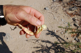
Mesquite beans, interesting flavor
At the turn around point, I was able to see three different palm oasis from a single location. Pushawalla Palms, Horseshoe Palms and Hidden Palms. We went over to the overlook of the lower end of the Pushawalla oasis and admired the unique fence. Then it was back toward the car.

End of the road partner
Since I like to make loops whenever possible, we went back along the Horseshoe Palms until the trail went up to Bee Rock Mesa.

Hiking up from Horseshoe Palms to Bee Rock Mesa
Once we arrived on the mesa we continued up and returned along the ridge. We didn't see our friend the snake, but we did see several horned toads. By this time the temperature was getting too warm for our enjoyment and we hurried back to the car.


Horned toads trying not be noticed/dinner

Base of the cliffs walking back to the car
The only thing I didn't like about the hike was the pictures didn't turn out as well as I would have liked. With the intense sun and hazy conditions, many of them were washed out. I will have to break down and learn how to use the manual settings on the camera one of these days, otherwise I'll have to put up with more ridicule and scorn from Dorothy.

Dorothy giving me a scornful look

No comments:
Post a Comment