Showing posts with label Indian Pass. Show all posts

Sunday, July 11, 2010

Looking For Rocks In The Desert?


This is part 3 of our trip to Indian Pass, Picacho Peak and the Tumco area.

After the climb, we still had plenty of daylight left, so we decided to check out some more items of interest in the area. As we headed away from Picacho Peak, we stopped to check out some vehicles we had seen from the summit.

Charlene the heavy equipment operator

Not too sure what this was?

While reading old issues of Desert Magazine, Roy found an article about rock hounds looking for a blue rock called dumortierite. I think it's more of a purple color, but to his own... . We stopped at a wide spot on the Indian Pass road and headed over to the closest wash that headed north. If we had been thinking more clearly, we would have combined this part of the trip with our visit to Indian Pass on the first day. The magazine article had mentioned that the source of the rocks were in the mountains to the north and they were washed down the into the washes. Well off we went and walked and walked and found nothing like what we were looking for for the longest time. Then, it occurred to me, the purple rocks that I was seeing every now and then were what we were looking for. After that they were easier to find, never in too much abundance, but enough to keep things interesting.

Charlene searching the wash for dumortietite
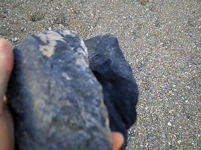
At last, we found some pieces

Sunset

After the search for the dumortierite, we set up camp along side the road and had a pleasant evening out under the stars. In the morning we woke, ate breakfast and decided that we would do about a half days worth of exploring before heading home. Our first stop was a small hill, that was a cyanite mine in WWII. The mineral appears to form the entire hill. The most interesting pieces were a light blue to green color.

Remnants of the mining operation

After exploring the mine, we then moved on to the old ghost town of Tumco. It was fairly intact up until the 1950s, at which time vandals systematically burned down all the wooden buildings, including a hospital.

Tumco was a gold mining company town

One of two cemeteries at the old town site

Remnants of a stone structure

One of the things that surprised me was how much broken glass we found

We won't accuse the builders of being master masons

I don't think anyone would call this the most hospitable place to live

Is finding a bullet out here kind of like finding a needle in a haystack?

Charlene standing next to some of the tailings

Hey, it's Vanna!

A chuckwalla among the ruins

I was impressed by the size of these leeching tanks. The gold ore was crushed into a powder and then put in these tanks with cyanide. The cyanide would cause the gold to separate from the rest of the material and then they would extract the gold and dump the rest of the tailings.

One of the tanks

They don't make them like this anymore

Charlene giving scale to the unstable looking tank and supports

With this many tanks there was a tremendous capacity and on some days they crushed up to 167 tons of ore a day, before the mine was exhausted in 1914.

One can't help but wonder how much cyanide is still in the tailings?

After Tumco, we decided to head for home. Along the way I snapped a couple of shots of this building. I've noticed it for some time, it appears to be old and certainly has unusual architecture.


Indian Pass Indian Trail


February came and it was time to get out again. Roy informed me that after our stellar performance in Joshua Tree, we needed to do some desert exploring. I agreed, since I had a good compromise in mind. With the information that Roy had been "feeding" me regarding the area around Picacho Peak, I thought that we needed to make another visit and see some of the other points of interest in the area.

Charlene, my youngest daughter, joined us so we had another set of hands to help out with the cameras and chores. We started out our trip going more east, through the town of Glamis, than we normally do. I hadn't been this way before and had a whole new appreciation for the sand dunes that are named after Glamis. On the east side of the dunes we made our first stop, at a Pre Columbian Indian Trail. The trail consisted of a section of trail along side of the highway, with a fence along the edges of the trail for few hundred feet. It didn't seem all that impressive, but over the next several hours it would become much more so.

Marker along highway, The sign says:

PRE-COLUMBIAN INDIAN TRAIL
COLORADO RIVER TO LAKE COACHWILLA
(NOW IMPERIAL VALLEY)
ERECTED BY
IMPERIAL VALLEY PIONEERS ASSN.
1965

I've never heard of Lake Coachwilla before, so I'm guessing they're referring to ancient Lake Cahuilla. The obvious age of the trail was the most arresting aspect of the site, along with a section just past the fenced area where the trail went what is a small wash, which has a spot where it appears that water would collect after rains and would have been an important stopping point on the journey.

Location where trail crosses dry stream bed, shaded spot in middle is where water collects.

We then continued the drive to an area known as Indian Pass. I had read about this area in articles in the old Desert Magazine and when searching the area on Google Maps, had seen what I thought were trails visible in the satellite photos of the area. Sure enough, the trail was easy to spot and follow. We ended up hiking much farther than I expected, a couple of miles, until we lost the trail in the sandy washes.

Here we are returning from the wash where we lost the trail. From all appearances, most people don't walk anywhere near this far from the road.

Where the trail goes through the rocks with the heavy patina or desert varnish, the trail is visible on satellite maps.

We saw several mortars along the trail

Following the trail with the pass in the background

Where the trail entered the area of white rock, it wasn't visible on satellite photos, but was still easy to follow.

Charlene checking out some mortars or grinding holes

In the upper middle part of this photo, you can make out a faint circle where the larger rocks have been removed. Many think these circles may have been campsites.

More grinding holes

The peculiar scratches on the rocks in this area, have not been found anywhere else

The trail through the heavy patina covered rocks

More of the mysterious scratches


Of course, graffiti is found in modern flavors as well. This are modern petroglyphs. After seeing the "modern art", we continued east through the pass toward the Colorado River.

Soon we found ourselves at Picacho State Recreation Area. Here Roy is paying the day use fee.

We then went down to the water and had a little picnic. The river is pretty here and we recognize these cliffs from our climbs of Picacho Peak.

Looking up river from our picnic spot

As we drove along the river we checked out some of the side canyons. Roy is looking at the cliffs, making sure that we don't need to climb them.

Charlene is looking at the pools of water from the rains about a week earlier

We are stopped from going any further by this waterfall

Some of the roads we check out are not designed for the family sedan. Note the dirt being sprayed by the driver's side front tire.

While driving along the river we came across this memorial to a dog called Lonesome. It's located on a small hill with a nice view of the river. I wonder how long before erosion will take away this little hill?

We stopped at a boat-in campground. While it's designed for boaters, you can walk in to it also.

One of our last stops of the day was the state park campground and visitor center. Of course you wouldn't want to be a visitor here in the old miner's cemetery. We took a little hike and checked out some of the sights, including the marina and then as the sun was getting lower in the west, we headed out for our last stop of the day.

After a very interesting day we finally set up camp, under the cliffs of Picacho Peak.