January 9 & 10, 2010
Ever since I first started climbing, I was always interested in climbs that sounded exotic, required some travel to get to and were not commonly climbed. Over the years I found that this often meant that the climbs were less than desirable for one reason or another. One of exceptions that I found is Picacho Del Diablo. This climb is in the very south east corner of California, in sight of the Colorado River. This climb had come to my attention early in my climbing career, but I had always thought that it was difficult, perhaps too difficult. Plus, I wasn't too sure how to find it. After about 25 years of climbing, it all came together and I was able to make the climb. This was in no small part due to the research that Roy does on our Southern California deserts. We found the rock and the climb and made the climb, which is a story in itself, but I'll save that for another time. This has become one of my favorite climbs, maybe it's too easy for most rock climbers, but I keep coming back again and again.
Whenever I really enjoy a climb, I like to share it and so for this trip I invited some folks from work. For various reasons when it came time to go, there was only one person from work willing to go, Kat. Roy and I would make the climb without anyone else, but we were glad to have Kat along. We left the Coachella Valley about noon on the 9th and started south. Kat was running late and she caught up with us in Felicity. See my previous blog for a little introduction to Felicity. Then we drove out into the wilderness arriving at dusk.

This is a view of Picacho as we were searching for our campsite

After doing a little scouting, we set up camp and started to enjoy the evening. One of the nice features of our campsite was that we had a nice little fire going. Roy had planned ahead and brought some tree trimmings from his yard for the fire. What I didn't realize was that he hadn't planned far enough ahead. The wood he brought for the fire was wood that he had cut just a few days previously. Much to our surprise, the fire needed a lot of attention to keep going.

Wet wood dripping into the fire

Of course many of those who know me are aware that I love the opportunity for educational experiences. Here is Kat perfecting her newfound technique for opening bottles with a carabiner.

After a nice cool evening camping out under the desert stars, morning arrived and Picacho loomed in the near distance.

I made a little breakfast which we all enjoyed (although they looked away when they said they liked it) while watching the sunrise on the surrounding peaks.

Roy telling me how much he is enjoying breakfast

After we finished eating, we started hiking and soon we were under the west face of the peak. Many consider this a forbidding view, and I have to admit that I did as well, the first time I saw it. Looking up from below there is no obvious route. When you combine the size with the lack of easy looking terrain, it's very daunting. You keep saying to yourself, this looks impossible, there's no way this can be as easy as the guides say. At the point where you have this view, the hike goes from interesting walking along a stream bed to a steep hike up the lower slopes.

Kat on the steep part of the approach, enjoying the views of the rock above

Soon we are at the end of the approach. We stop to change our shoes and catch our breath. We also took advantage the views, the altitude gain already has us about half way to the top.

Soon we are on our way. As we work our way up the climb, Roy stops at the base of the infamous step across crack. Kat is saying, hey, so far so good.

Moments later we arrive at the first difficult section. The first time I made the climb there wasn't a ladder at this point. The ladder makes it much easier. Kat is looking on in disbelief, this is no way OSHA compliant.

Kat at the step across, she is saying something like "you want me to do what?"

Roy showing how it's done, making the leap of faith across the step across

The route consists of these half tubes in the side of the vertical cliff, they diagonal up one way till they end, then diagonal the other way, zig zagging the way up in a very improbable series of easy ramps.

Soon we reach the second ladder. The first ladder looks spacious compared to this one, if it looks long and narrow, that's because it is. Note that it's tied off on top with an old sling and the little pile of rock at the bottom is for psychological purposes, because it won't do any real good in securing the base of the ladder.

After ascending the second ladder, you break out onto the north shoulder of the peak. If you look carefully you can see the Colorado river in the background behind Roy. At this point we are very near the top and almost a thousand feet above the desert floor.

We continue up a gentle slope and over a false summit to reach the only technical climbing on the whole route. After going down a short way from the false summit, we reach a large block. At the end of this block we climb about a fifteen foot fifth class section of climbing and then walk about 70 feet across the block to the south end and do a rappel, again about 15 feet.

Roy on the rappel

After the rappel, we walk a few hundred feet further and we're on the true summit

At the summit we signed the register and had a snack, here Kat is adding her words of discouragement to those who come behind.

Once we finish enjoying the views from on top, it's time to go back down. Except where we had to make the rappel going to the top, now we have to ascend the rope to go down. Here I am just reaching the top of the rope ascent.

Kat coming up the rope

Kat making sure that the ladder is properly footed, just like she has been trained to do

By this time on the descent, the sun is on the west side of the mountain and we are going down in the sun. We're almost back down to where we changed our shoes.

Kat and Roy on the last little stretch before the notch where we changed our shoes

After changing our shoes, we then head down from the notch, the gully lead to the notch is steep and hot in the afternoon sun. Kat and Roy are just visible in the center of the picture.
After making our way down to easier terrain it took about a half an hour to get back to the cars. Then it was the drive out, with a minor issue of Kat getting stuck just at the intersection with the main road out to the highway. A quick push and she was on her way. The rest of the drive was uneventful, unless you consider people walking their pigs in a park... .
 As we enter the Palm Wash, the effects of the recent rain are quite apparent with all the mud. Fortunately the rains were mild and we have firm ground for the most part.
 One thing that we notice about the rain, is that the wet conditions really bring out the colors. Normal dry conditions give a lot of pastel colors, but when wet they really stand out. The different colors are a result of flooding by the Colorado River a very long time ago, Roy says before he can remember.
 Our first stop is the natural bridge. This is a column of sandstone that eroded away at the base until it fell over and caused this natural bridge. It's different than what you would normally expect in the desert southwest, but it's what we have here in the local desert.
 After visiting the bridge, we get back on the road to the Calcite mines and start noticing the scenery. This part of the wash appears to be about 400 feet deep. About this time we are very impressed with the canyons and wish the road was a little wider.
 Soon we are at the mine area and start taking in the views. Here Roy is taking in the vistas, with the Salton Sea in the distance and Red Top off to the right.
 Soon we are looking at the mines. The calcite was formed in cracks in the ground and the method of mining was to dig out the dikes of calcite that were formed. This resulted in a landscape covered with trenches. Here we are looking into on the of the trenches, this is one of the more vertical ones we saw.
 While exploring we kept taking time to appreciate the magnificent scenery, this is looking out at the badlands and the road we drove in on.
 Here is another trench, notice that there were no machines digging here, the walls have the unmistakable scars from pick work. Not an easy way to make a living.
 After checking out the mine site we noticed a trail heading up the mountain to the north and decided to follow it.
 As I was walking along the ridge, I noticed a crack in the ground. I thought to myself that I wouldn't want to step in the crack, might break a leg, but then another thought came to mind. If I'm walking along a ridge, where does this crack go? As I started looking more carefully, I realized that it was part of erosion and that one side of the ridge was beginning to separate from the rest and would be falling down the side of the steep slope. I quickly made sure I was on the side that would be staying for a bit longer.
 Looking down at Roy coming up the trail, you can see the split in the ridge. The right side is breaking away from the rest of the ridge and will cause a significant rock slide when it goes. Yes, it is easily big enough to step in.
 We were fortunate that the Ocotillo were in bloom, giving us some bright color in the desert. As we continued up the ridge, with some sections very steep and some fairly level, it soon became clear that we had underestimated the size of the mountain and decided to turn back.
 Going down it was more noticeable how narrow the ridge was in places. This is not much more than a use trail and as you can see, the slopes drop off right away. With the steepness of the slopes, this was a very scenic hike.
 Once back down we decided to do some exploring in the badlands area. Here we are looking back up at the mountains, we turned around on the flat section in the middle of the skyline. At first we thought the ridge was rugged, coming into this area we had to redefine the term.
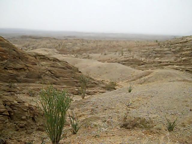 As we started this second hike of the day, Roy had asked me if I thought we would be able make the trip before the rain came, we could see it off in the distance. I thought it appeared to be moving slowly and told him that it would be fine, we'd be back in plenty of time. If you know me, you know that I normally don't do rain. Once we had hike out into the canyons and whetted our appetites for hiking in the area, Roy told me that we should turn around soon, since he figured that the rain was about 10 miles away and heading in our direction. With that he turned around and started heading back to the car.
 I couldn't quite bring myself to turn around quite so soon, I had too much to look at, including this canyon. I quickly changed my mind when I realized that Roy's 10 mile estimate was a bit off, it should have been 1/10 of a mile. I was in high gear (for me) getting back to the car before I got too wet.
 All too soon the sky completely opened up, but not before I made it back to the car. As we were driving out we noticed some young men hiking in, wearing blue jeans and hooded sweatshirts. I guess they really wanted to make the hike to continue in such a heavy rain, no doubt they were totally soaked in a few minutes. We didn't let it dampen our spirits, we knew we had just scratched the surface of what the are has to offer and were already making plans to return.